
Survey
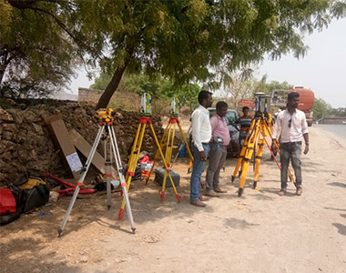
Road & Highway Survey Project
Good roads and highways are the most important public assets any of the country. Timely enhancement of roads and highways bring immediate and great benefits to communities and people as the better roads and highways give easy access to hospitals, schools, markets with greater comfort, speed, safety and lessen transportation cost.
For the betterment of the country a time to time a surveys should be conducted for roads and highways to determine the condition of the roads, highways and the location of any potentially dangerous voids. These timely roads and highways surveys can be conducted at reasonably fast speeds; therefore it will help in eliminating the need of any road closures.

Irrigation Project
We has surveyed and designed irrigation projects. Our services in this field include complete survey analysis, layout design, earthwork design and the preparation of plans and specifications for Tendering purposes.
Through this work, we have established a good reputation for a professional approach to survey, design and construction supervision. To date, we has been involved with the survey and design of hectares of irrigation for the production of cotton, fodder, small crops and orchards. The Company’s design skills are based on accurate surveying, modern computer assessment, design, and computer drafting..

Railway Survey
Railway surveying has always been of vital importance in the maintenance and construction of our railways but recent dramatic increases in traffic and the resulting pressure to expand capacity has significantly raised the profile of the railway regeneration. More than ever before survey companies working on the railways need a solid background of experience, efficiency and expertise..
Our Company has been involved with railway surveying since many years.We are experienced at working day and night on stations, embankments, tunnels, plain line, renewals and drainage surveys. A quick review of the other tabs in this section of our site will demonstrate our success in completing projects on the railways.
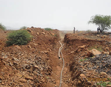
Water Supply Survey
Urban demand for water shows a great deal of uniformity in its use, this being One of its main features. This is because it includes both domestic use and other Uses of water, such as municipal, collective, industrial, commercial, as well Agricultural use. In turn, the tourist industry and the second homes generate, in Many region, a large demand on its supply, and may even end upExceeding demand corresponding to the population habitually resident there...
The need to have access to reliable and regular data regarding uses of water is Without question. In light of this, developing a statistical information system for Monitoring and assessing current and future political actions regarding water Management..

Building Planning
At Bharat Engineers Surveys, we have an expert team of building surveyors. We provide you with the best of the lot surveyors, who will cover every aspect of your project. our surveyors are well experienced and proficient in areas concerning insurance and legalities of the matters associated with the survey...
Though, with our Surveys, chances of something going wrong are really rare, but still, being a premier surveying firm, we do not want to take chances. The building condition surveys that we carry out at Bharat Engineers Surveys, are wide-ranging in the sense that they include every potent loss to be envisaged and give you the accurate picture.

Land Survey
While buying and selling land it is essential to survey the land so that the exact measurement of the land can be arrived at. Since the rate of sale and purchase is known, it is quantum of land that will be used to arrive at the total price to be paid or received. The same logic applies when Government is acquiring land from the public for some project etc.
The government on its own carries out land survey so that the charts and maps can be updated. This is required to be done in order to ensure that the charts and maps are updated at regular intervals. Very often due to natural calamities the entire demography of the area is changed. In such cases it becomes imperative to redo the land survey..
Topographic Survey
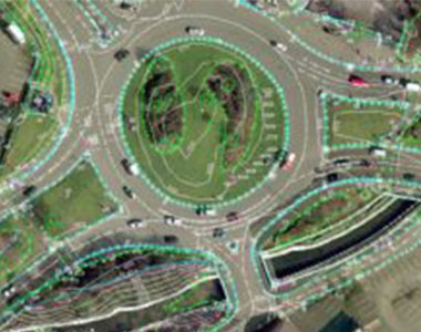
Topography of a place is its landscape, geography and countryside, or in other words it can be shape of a plot or the features found on it. A surveys company is often asked to carry out Topographical Surveys for clients as they intend to effectively utilise the land for development of a project..
The land could be undulating, uneven and having slope etc in the wrong direction. Often companies do purchase undulating land as it is cheaper that totally developed and levelled land. After Topographical surveys required areas are prepared and made uses of, resulting in substantial saving to the company.We are leading providers of topographical surveys..
Contour Survey
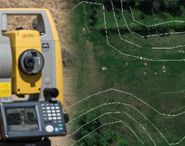
Contouring in surveying is the determination of elevation of various points on the land and fixing these points of same horizontal positions in the contour map.
In the land property world, a contour is an outline of a mass of land. Main objective of conducting contour surveys is to identify any noticeable difference in elevation of the existing land. In land surveying a contour map is a map illustrated with contour lines, for example a topographic map, which thus shows valleys and hills, and the steepness or gentleness of slopes.
Main Canal Alignment
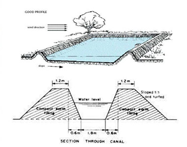
Alignment surveys is predominately used where linear alignment is of utmost importance. The one in sixty rule states that when an error of one degree is made in the alignment then after sixty miles the offset would be to the tune of one mile.
If alignment survey is not carried out at regular intervals the pipelines would never reach the destination. If a detour is thus made it will inflate the cost of the project as a onetime measure but on a regular basis the pumping cost will increase as the crude has to be pumped to a longer distance.Lying of the railway line is another area that requires very high calibre of alignment survey.

Tunnel Survey
Tunnel construction sites are often vast. Apart from a competent technical execution of our work, experience, anticipation and factors often not valued as important, are also taken into consideration.
We are social working conditions, personnel management and adherence to legal employment regulations, are contributing factors in keeping the fluctuations in staff at an overall low. This means that site-specific information and knowledge is retained within the company for longer. The many years of experience that our employees possess are extremely valuable for this part of the survey work..

Dam Survey
Dams construction are the most crucial part among all construction. Majorly dams are constructed with rock-fill and earth materials.Earth-fill dam structures are simple and useful to prevent sliding due to self-weight.Identifying and fixing the constructed dams fault are post effect of resulting floods from Dam Breach..
As the failures and faults are threats to public safety, hence it requires time to time maintenance and analysis. The predominant parameters are the attenuation, travel-time and other routing effects. The breach parameters like breach width, depth and rate of development are exclusively designed by our Engineers. We specially take care of all faults and fix them on time..
Building Demarcation
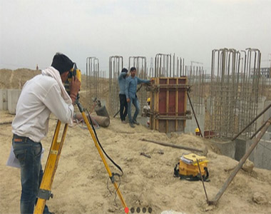
Our company is into demarcation survey and we provide to our valued customers a best quality range of Demarcation Survey. The equipment used is the latest available in the market. Moreover the surveys that are conducted by our team of experts are widely appreciated for their accuracy, reliability, flexibility, timeliness and cost-effectiveness. We also make sure to offer these services stringently in harmony with the set industry values..
The demarcation services offered by us are widely used by the real estate developers and civil construction segment. Our team of experienced and talented professionals, who undertake the responsibility are well trained and also have an in-depth knowledge and requisite experience to carry out the survey as per the requirement of the clients...

Digital Levels
Digital levels improve standards for levelling on construction sites and general surveying tasks. They are simple to use, take measurements quickly, and minimise human error, while the integrated programs enhance levelling work. Experience shows that with a digital level there is up to 50% time saving when compared with conventional levels.
Mumbai To Gujarat Bullet Train Survey 250 Km
Trivandrum To Kasargod 798 Km Survey
DGPS Survey
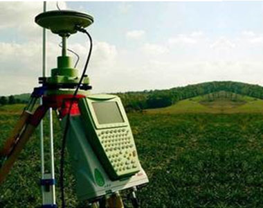
Differential Global Positioning System (DGPS) is an enhancement to Global Positioning System that provides improved location accuracy, from the 15-meter nominal GPS accuracy to about 10 cm in case of the best implementations.
DGPS (Differential GPS) is essentially a system to provide positional corrections to GPS signals. DGPS uses a fixed, known position to adjust real time GPS signals to eliminate pseudorange errors. ... DGPS has no effect on results that are based on speed data, such as brake stop results.
